


River Amata. Rocks and Cliffs
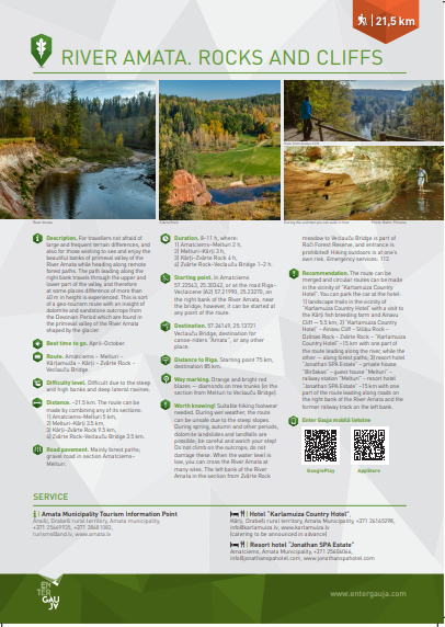
For travellers not afraid of large and frequent terrain differences, and also for those wishing to see and enjoy the beautiful banks of primeval valley of the River Amata while heading along remote forest paths.
The path leading along the right bank travels through the upper and lower part of the valley, and therefore at some places difference of more than 40 m in height is experienced. This is sort of a geo-tourism route with an insight of dolomite and sandstone outcrops from the Devonian Period which are found in the primeval valley of the River Amata shaped by the glacier.
Route
Amatciems – Melturi – Kārļamuiža – Kārļi – Zvārte Rock – Veclauču Bridge.
Distance
~21.5 km. The route can be made by combining any of its sections: 1) Amatciems–Melturi 5 km, 2) Melturi–Kārļi 3.5 km, 3) Kārļi–Zvārte Rock 9.5 km, 4) Zvārte Rock–Veclauču Bridge 3.5 km.
Attachments:
09_ENG_Amata_2020_web.pdf (950.32 KB)
Voting:
Useful links
Conferences and seminars
Guided tours in Sigulda
Medical tourism
Useful information

Cross-country ski track

Events