


From Līgatne to Cēsis
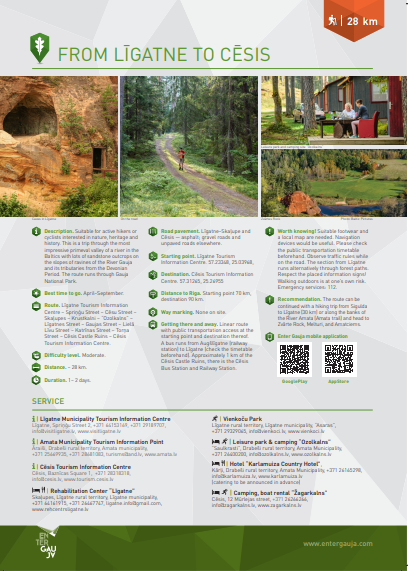
The route takes you from Līgatne to Cēsis, with sightseeing objects on the way (check PDF file for description and map of the objects!). Suitable for active hikers or cyclists interested in nature, heritage and history.
This is a trip through the most impressive primeval valley of a river in the Baltics with lots of sandstone outcrops on the slopes of ravines of the River Gauja and its tributaries from the Devonian Period. The route runs through Gauja National Park.
Route
Līgatne Tourism Information Centre – Spriņģu iela – Cēsu iela – Skaļupes – Krustkalni – Rakši – “Ozolkalns” – Līgatnes iela – Gaujas iela – Lielā Līvu iela – Katrīnas iela – Torņa iela – Cēsis Castle Ruins – Cēsis Tourism Information Centre.
Distance
~28 km
Attachments:
08_ENG_Ligatne_Cesis_2020_web.pdf (1.06 MB)
Voting:
Useful links
Conferences and seminars
Guided tours in Sigulda
Medical tourism
Useful information

Cross-country ski track

Events